The Juan de Fuca Trail is a breathtaking multi-day backpacking route that stretches 47 kilometers (29 miles) along the southwest coast of Vancouver Island in British Columbia, Canada.
While often overshadowed by the neighboring and more famous West Coast Trail, the Juan de Fuca Marine Trail still remains one of the best backcountry hikes that Vancouver Island (and British Columbia itself) has to offer.
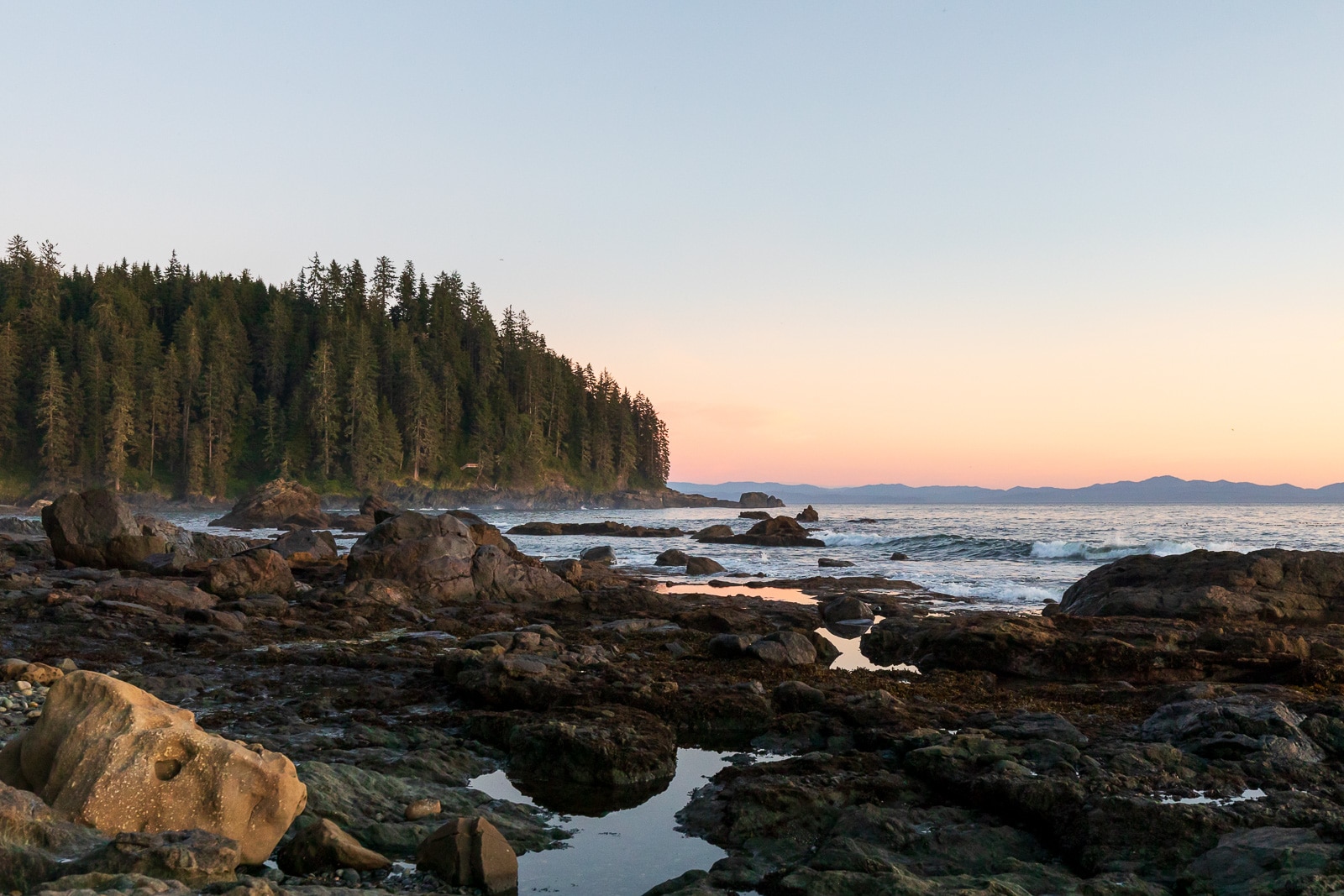
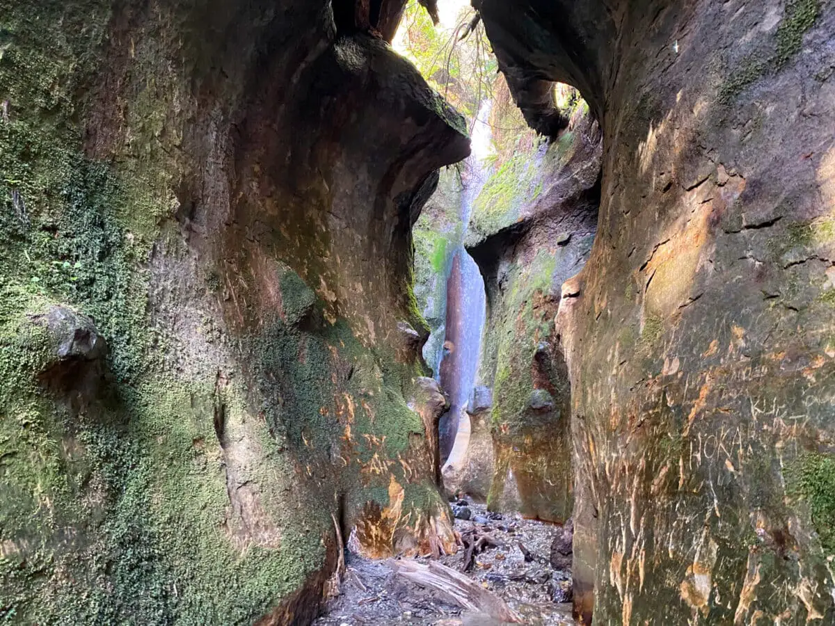
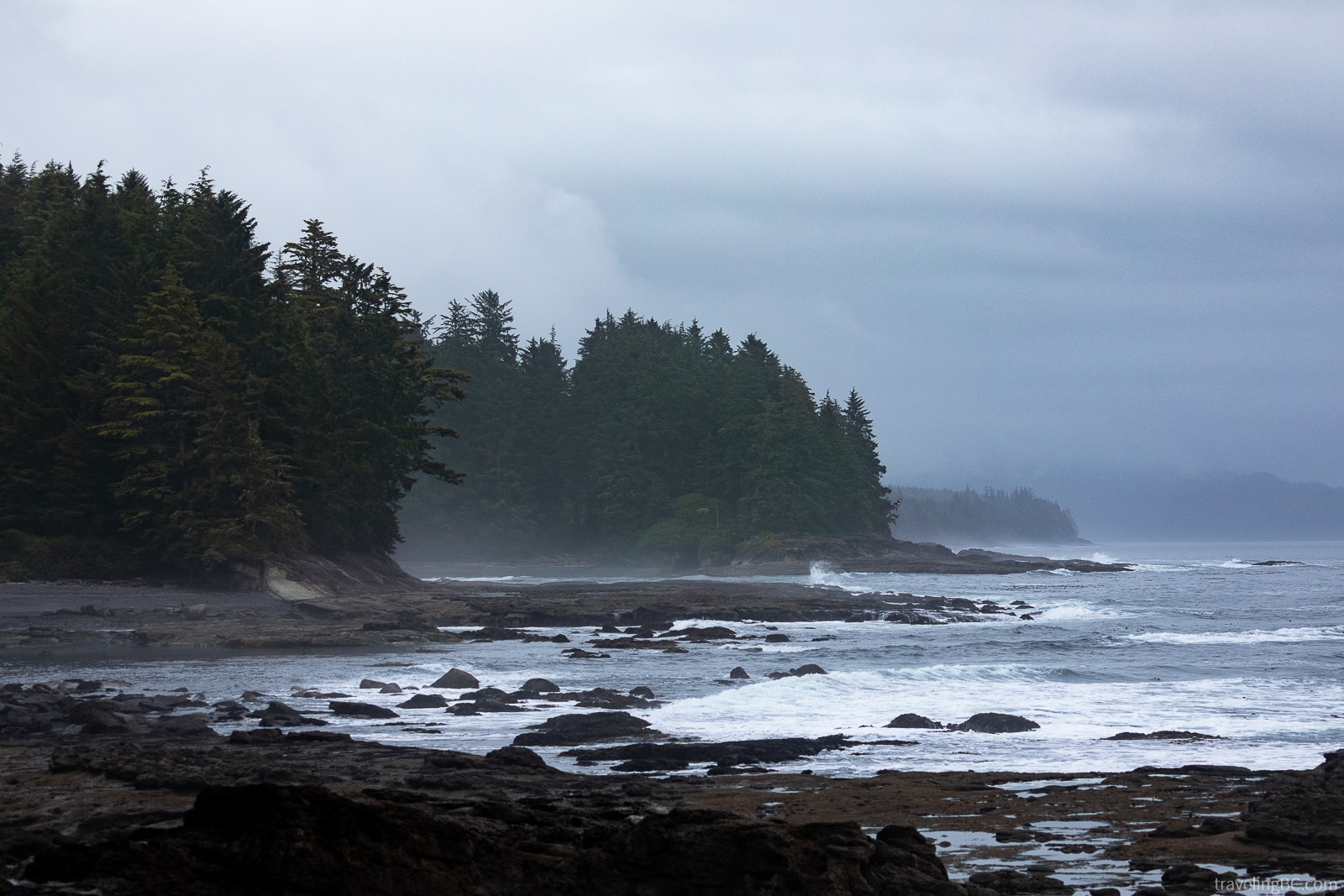
From beachside waterfalls and mossy forests to incredible tidepools and sea caves, this breathtaking backpacking trail weaves its way through the lush coastal wilderness of Vancouver Island’s Juan de Fuca Provincial Park.
With the trail close to our hometown of Victoria, BC, we’ve spent plenty of time hiking and camping along the Juan de Fuca Trail. It’s one of our favorite hiking trails on Vancouver Island!
We’ve put together this guide to help you plan your own adventure on the Juan de Fuca Trail. Below, we cover everything you need to know about hiking the Juan de Fuca Trail, including a packing list, hiking itinerary, trail highlights, hidden gems, and tips to make the most of your experience!
Juan de Fuca Trail Overview
Location: Between China Beach (close to Sooke) and Botanical Beach (close to Port Renfrew) in Juan de Fuca Provincial Park, British Columbia, Canada
Distance: Approximately 47 kilometers (29 miles)
Difficulty: Moderate to Challenging
Time: Typically 3 to 5 days
Cost: $30+
When to Go: Open year-round but best in May to September (the off-season between October to April gets rainy and muddy).
Dogs Allowed: Yes, on-leash only
Juan de Fuca Trail Description
The Juan de Fuca Trail (or the JDF Trail, for short) is a multi-day hiking trail located on the southwestern coast of Vancouver Island in British Columbia, Canada.
Stretching for approximately 47 kilometers (29 miles), the trail runs alongside the coastline of its namesake, the Juan de Fuca Strait. Part of the Salish Sea, this body of water separates Vancouver Island from the mainland.
The Juan de Fuca Trail is often considered a shorter and slightly less challenging alternative to the nearby West Coast Trail, which is directly to the northwest. Even so, the JDF still offers an incredible wilderness experience!
The trail winds its way through lush temperate rainforests, across rocky beaches, and to stunning coastal vistas. Many of the campsites, like Sombrio and Mystic, are just steps away from the ocean!
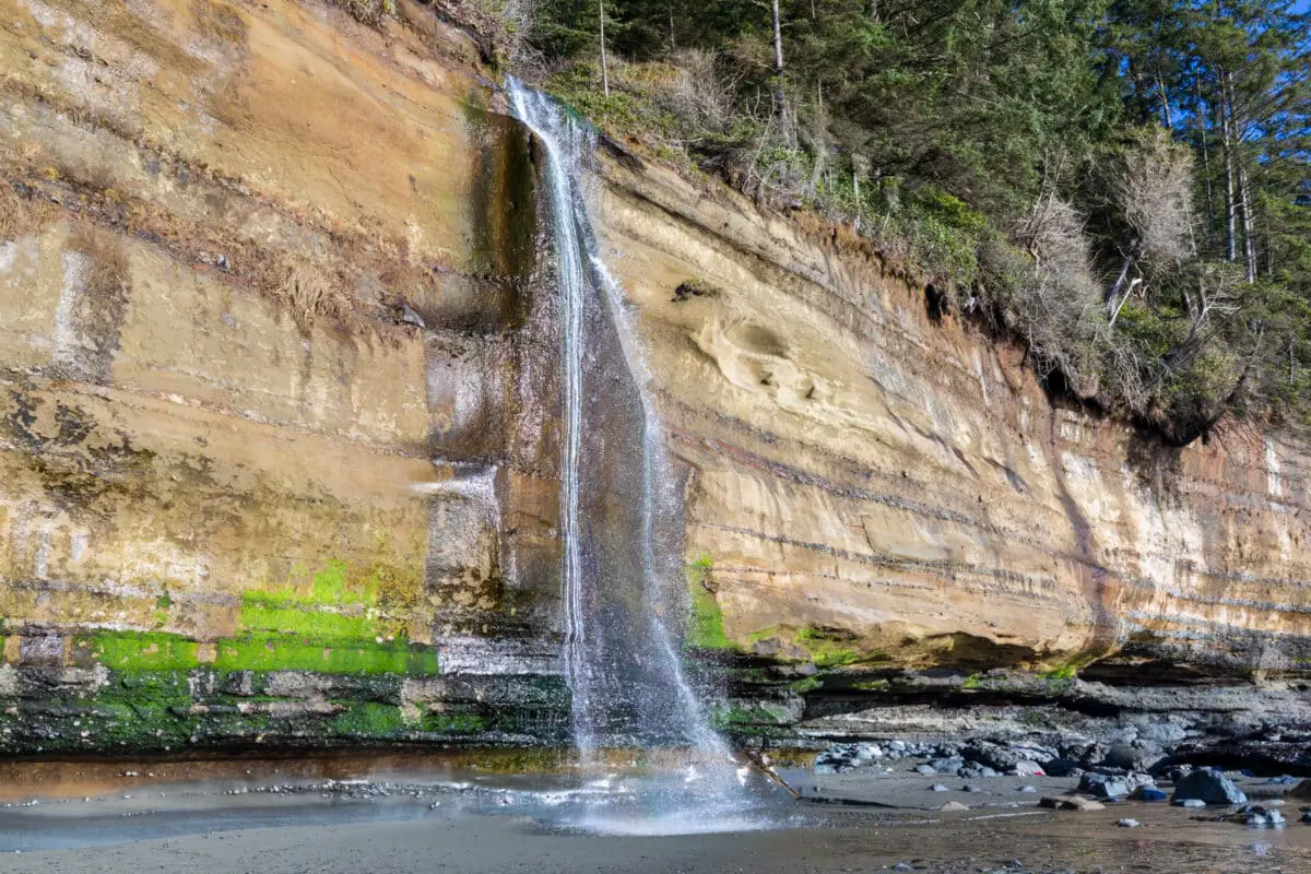
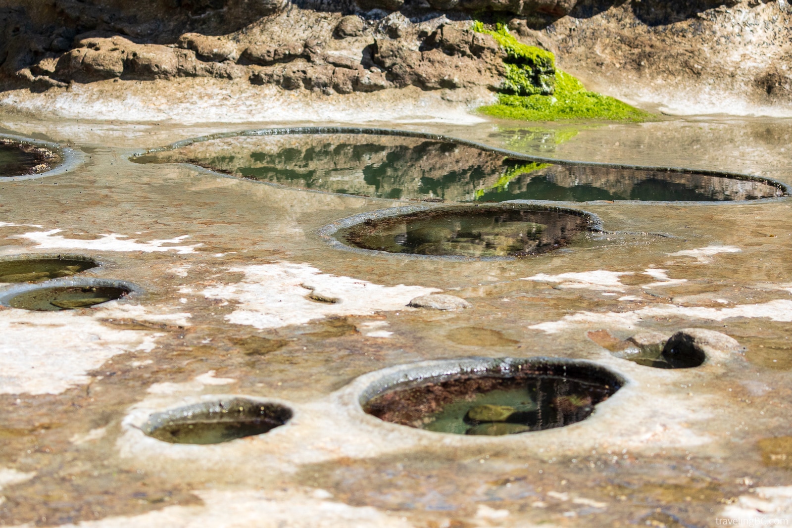
Some popular highlights along the Juan de Fuca Trail include Sombrio and Mystic Beach, which both are beautiful beaches with waterfalls, and Botanical Beach, which is renowned for its tidal pools filled with diverse marine life.
Known for its moderate to difficult terrain, the trail has sections that can be steep, muddy, and slippery, especially during the wetter seasons.
Where Exactly Is the Juan de Fuca Trail?
The Juan de Fuca Marine Trail runs through Juan de Fuca Provincial Park, a protected area on the western coast of southern Vancouver Island, British Columbia.
The trail goes between the China Beach and Botanical Beach trailheads. China Beach, the southernmost trailhead, is just past the tiny community of Jordan River, as well as Shirley and Sooke. Botanical Beach, on the northern end of the trail, is close to Port Renfrew.
There are also trailheads at Sombrio Beach and Parkinson Creek, which give you access part of the way through the trail.
Parkinson Creek Trailhead, Minute Creek Forest Service Road, Rural Resource Lands, Juan de Fuca Electoral Area, Capital Regional District, British Columbia, Canada
Payzant Creek, Juan de Fuca Marine Trail, Rural Resource Lands, Juan de Fuca Electoral Area, Capital Regional District, British Columbia, V0S 1K0, Canada
West Sombrio Beach Campsite, Juan de Fuca Marine Trail, Rural Resource Lands, Juan de Fuca Electoral Area, Capital Regional District, British Columbia, Canada
Little Kuitshe Creek, Juan de Fuca Marine Trail, Rural Resource Lands, Juan de Fuca Electoral Area, Capital Regional District, British Columbia, Canada
Chin Beach, Juan de Fuca Electoral Area, Capital Regional District, British Columbia, Canada
Bear Beach, Juan de Fuca Marine Trail, Rural Resource Lands, Juan de Fuca Electoral Area, Capital Regional District, British Columbia, Canada
Mystic Beach, Juan de Fuca Electoral Area, Capital Regional District, British Columbia, Canada
China Beach, Juan de Fuca Electoral Area, Capital Regional District, British Columbia, V9Z 1L1, Canada
Botanical Beach, Juan de Fuca Electoral Area, Capital Regional District, British Columbia, Canada
How Long Is the Juan de Fuca Trail?
Officially, the Juan de Fuca Trail is 47 km (29 miles) long from the China Beach trailhead to the Botanical Beach trailhead.
However, don’t expect to hike exactly 47 km. Many hikers who record their tracks find that they’ve walked several kilometers further.
Over the years, infrastructure has been rebuilt, trees have fallen, etc. These changes have likely impacted the trail length slightly. You’ll also likely walk extra to explore some of the beautiful beaches!
How Many Days Is the Juan de Fuca Trail?
Typically, hikers take between 3 to 5 days to complete the entire Juan de Fuca Trail, one-way. We prefer hiking the trail in four days, so we have some time to relax along the way!
Of course, the amount of time that you’ll need depends on your hiking style. Speedy backpackers complete the trail in a couple of days, while others may prefer a more leisurely pace and spend up to a week on the trail.
Some people even run the entire trail in one day!
Plan your trip based on your fitness level, hiking experience, and average pace. And of course, the trail will take longer as an out-and-back trail, rather than a one-way hike.
How Difficult Is the Juan de Fuca Trail?
The Juan de Fuca Trail is a moderately challenging trail. The terrain is rugged and varied, with sections of hills, slippery mud, uneven ground, creek crossings, exposed tree roots, boardwalks, and rocky beaches. There are also bridges and ladders to navigate, and tides to plan around.
The trail is quite hilly. You’ll have a total elevation gain of 1,451 meters, despite the trail following alongside the coast!
Additionally, the trail gets quite muddy and slippery, particularly in wet weather. This definitely adds to the difficulty. Appropriate footwear with good traction is a must!
Much of the infrastructure along the Juan de Fuca Trail is aging and broken, making it unsafe for hikers. Luckily, BC Parks recently upgraded the boardwalk, stairs, and bridges between Mystic Beach and Chin Beach.
Other multi-day coastal Vancouver Island trails that are comparable to the Juan de Fuca Trail are the West Coast Trail and the North Coast Trail. The Juan de Fuca is definitely easier than the North Coast Trail but about on par with the West Coast Trail.
The JDF is way less muddy and remote than the North Coast Trail, so it’s a better choice for inexperienced backpackers. The West Coast Trail has fewer hills and better infrastructure, but more mud and takes longer than the Juan de Fuca Trail.
Overall, the Juan de Fuca Trail requires careful planning, preparation, appropriate gear, and a moderate level of hiking experience. It’s important to be adequately prepared, including being aware of the trail conditions, checking tide tables, and carrying proper gear.
When Is the Best Time to Hike the Juan de Fuca Trail?
The Juan de Fuca Trail is open year-round, but the best time of year to go is May through September. In summer, there will be less rain (and less mud), more sun, longer days, and the shuttle bus will be running.
However, the trail is busiest during summer. The peak season is July and August. Long weekends are especially busy. Campgrounds that are easier to get to, like Sombrio or Mystic, will be packed with day users and overnight campers. You might have to start your day earlier to get a good campsite!
Sometimes, the shoulder seasons (April and October) are a great time of year to hike the JDF. The trail will be less crowded, in better condition than winter, and weather can be good (but it’ll be more rainy than summer).
There’s also a higher chance that you’ll be able to have a beach campfire during the shoulder and off seasons. Usually, there are fire bans on Vancouver Island that run through the summer.
Winter months bring stormy conditions. Expect lots of rain and mud, and cold nights. Some people still hike the JDF during winter, but it’s less recommended and you’ll need to be very prepared if you do. A good rain jacket, rain pants and warm clothes are a must. Waterproof hiking boots and gaiters are also essential.
The shuttle bus only runs May through September though, so you’ll need to arrange your own transportation from October through April.
How to Get to the Juan de Fuca Trail?
There are two main recommended ways to get to the Juan de Fuca Trail: 1) driving to the trailheads, or 2) taking the shuttle bus. You might need to combine these options, if you are hiking the trail as a thru-hike and only have one vehicle.
Below, we give more information on each option.
Driving
Driving is a common and easy option for accessing the Juan de Fuca Trail.
Because the trail is usually completed in one direction, ideally you’d leave one car at one trailhead and another car at the end. If you don’t have a friend with a second car, you can take the shuttle bus back to your vehicle, though. Some people also hitchhike (but it’s illegal to do so).
It’s important to note that the trailheads have limited parking and fill up quickly in the summer. Arrive early! Carpooling is recommended.
Also, thieves commonly target unattended vehicles in the trailhead parking lots. While we haven’t had a problem yet, there’s always a chance it could happen to you. Don’t leave any valuables in your vehicle while you hike the trail!
Driving Directions From Victoria
From Victoria, you’ll start by following Highway 1 (Trans-Canada Highway) westbound. Then, take Highway 14 out of the city, following signs for Sooke and Port Renfrew. Along the way, you’ll pass through Sooke and Shirley — make sure to stop at Shirley Delicious for a snack!
China Beach Trailhead: You’ll find the China Beach trailhead on your left, shortly after you pass by Jordan River. Don’t stop at the China Beach campground — you want the day use area. Look for the blue sign that says “Juan de Fuca (China Beach) Day Use”, and then turn left into the parking lot.
Sombrio Beach Trailhead: If you’re starting at Sombrio Beach, continue past China Beach for about 20 km until you see the blue sign for “Juan de Fuca – Sombrio Beach – Marine Trail”. Turn left onto the gravel road, and follow it for about 2 km downhill until you reach the parking lot. The road can be rough and busy, so take it slow!
Parkinson Creek Trailhead: To get to the Parkinson Creek Trailhead, keep going along Highway 14, past Sombrio Beach by about 10 km. After you see the blue sign for “Juan de Fuca – Parkinson Creek – Marine Trail”, turn left onto the gravel road and follow it for 3.7 km to the trailhead. The road may have lots of potholes, so watch out!
Botanical Beach Trailhead: Lastly, if you want to start at Botanical Beach, head past all of the other trailheads until you arrive in the town of Port Renfrew. Follow the road through town, until you see a blue sign pointing you left onto Cerantes Road for Botanical Beach. The trailhead is about 3 km past this turn off.
Driving Directions From Nanaimo
If you’re coming from Nanaimo, you have two choices: 1) drive to Victoria and follow the directions listed above to get to the trailheads, or 2) head through Lake Cowichan and follow the Pacific Marine Road.
Heading through Lake Cowichan can be a bit faster (except if you’re starting at China Beach). For this route, you’ll want to head south from Nanaimo on Highway 1. Just before you get to Duncan, you’ll see a blue sign pointing right for “Gordon Bay / Carmanah Walbran / Cowichan River”. You’ll want to turn right onto Highway 18 (Cowichan Valley Highway).
Follow Highway 18 through Somenos and to the town of Lake Cowichan. When the road branches, take the left branch, following the signs for Lake Cowichan and Mesachie Lake onto South Shore Road. Continue through and out of town, until you arrive at Mesachie Lake.
Here, you’ll turn left onto Pacific Marine Road, following signs for Port Renfrew. Head south on this road for 50 km, until turning left onto Deering Road. Drive this road for about 3 km, until turning onto Highway 14, either right to get to Botanical Beach or left to get to the other trailheads.
Botanical Beach Trailhead: Once you turn right onto Highway 14 (Parkinson Road), follow the road for about 5 km through Port Renfrew, until you arrive at Cerantes Road. Turn left, following the sign for Botanical Beach, and drive for about 3 km until you reach the trailhead parking lot.
Parkinson Creek Trailhead: For all of the other trailheads, you’ll want to turn left from Deering Road, onto Highway 14. Follow Highway 14 east for 9 km until you see the blue sign for “Juan de Fuca – Parkinson Creek – Marine Trail”. Turn right onto the gravel road, and follow it 3.7 km to the trailhead’s parking lot. Watch for potholes!
Sombrio Beach Trailhead: To get to the Sombrio Beach Trailhead, continue past the Parkinson Creek turn-off for 12.7 km until you see the “Juan de Fuca – Sombrio Beach – Marine Trail” sign. Then, turn right onto the gravel road which you’ll follow for 2 km downhill until you reach the parking lot.
China Beach Trailhead: Lastly, to get to the China Beach Trailhead, continue past Sombrio Beach on Highway 14 for about 20 km until you see the “Juan de Fuca (China Beach) Day Use” sign. Then, turn right into the parking lot. Note, if you’re starting at China Beach, you might want to head through Victoria instead of going all the way through Port Renfrew (it’s usually faster)!
Juan de Fuca Trail Shuttle Bus
The Juan de Fuca Trail Shuttle Bus, run by the West Coast Trail Express, is a convenient option for those without a vehicle.
The bus has stops in Victoria, Sooke, Jordan River, China Beach, Sombrio Beach, Parkinson Creek, and Port Renfrew. It also connects to Nanaimo, through a transfer in Lake Cowichan.
Reservations are strongly recommended, especially in the peak season. If you’re coming to/from Nanaimo, reservations are required!
For China Beach, Sombrio Beach, and Parkinson Creek, the bus stops beside the highway. You’ll have to walk in to access the trailheads. The walk to China Beach is only 200 m. To Sombrio Beach, it adds on a 2 km walk. To Parkinson Creek, you’ll have a 3 km walk.
For Botanical Beach, the bus stops in Port Renfrew by Cerantes Road. You’ll have to walk along the road for about 3.2 km to reach the trailhead.
It’s a bit inconvenient — but at least it’ll get you to the trail!
The bus services runs once a day, going in each direction. The bus departs Victoria at 6:45 am and arrives in Port Renfrew at 8:45 am. Later, it departs Port Renfrew at 5:45 pm and arrives in Victoria at 7:45 pm. Check here to see the schedule.
The shuttle cost varies, depending on your pick-up and drop-off locations. Generally, it costs between $30 to $60 one-way, although getting to/from Nanaimo costs $125 to $140. Refer to their bus fare chart to see exactly how much you’ll pay. They give discounts if you book a two-way trip.
The bus only runs from May 1 to September 30. However, groups can charter a bus during the off-season, if necessary.
Which Direction Is Best for Hiking the Juan de Fuca Trail?
If you want to hike the entire Juan de Fuca Trail, you can either start at Botanical Beach and head south, or at China Beach and head north. But, which trailhead should you start at — China Beach or Botanical Beach?
The answer is… one direction isn’t any better than the other! Each direction has a similar level of difficulty. And you’ll get to experience the same beaches and views, regardless of the direction that you pick!
Where you decide to start depends completely on your preferences. You can determine which direction to hike the Juan de Fuca Trail by asking yourself the following questions:
- How are you getting to the trail: Are you taking the shuttle or leaving vehicles at the trailheads? If you’re taking the shuttle, you’ll need to plan around the bus schedule. If you are driving one-way and taking the bus the other way, you might find it easier to take the early shuttle to Port Renfrew and hike back to your car at China Beach. Then, you don’t have to worry about timing the end of your hike!
- Do you prefer a longer drive on the way there or the way home: It takes about an hour to drive from China Beach to Botanical Beach. Would you rather drive this extra hour on the first day when you aren’t exhausted or save it for the last day?
- When do you want to tackle the more difficult sections: Bear Beach to Chin Beach is often considered the most difficult section. Would you rather get it out of the way first, when you are less exhausted but have a heavier pack? If so, start at China Beach and hike north. Alternatively, head south from Botanical Beach and leave the more difficult section for later, when you have a lighter pack and are more used to the terrain.
- Which hiking direction fits with the tide schedule: The tide plays an important role in hiking the Juan de Fuca. High tides will cut-off beach crossings at Bear Beach, Chin Beach, and Sombrio Beach. If one direction matches up better with the low tides, we recommend following the trail in that direction!
- When are you planning to hike the trail: On summer weekends, the trail gets quite pretty busy with campers and day-users, especially at Sombrio and Mystic. If you can, try to plan your trip so that you camp at these beaches on a weekday to avoid the crowds.
- When can you see Botanical Beach at low tide: You don’t want to miss the tide pools at Botanical Beach, which require a low tide to be seen (check the Port Renfrew tide tables). Catching Botanical Beach at low tide might be easier if you hike north to south. Alternatively, if you can time your arrival, save Botanical Beach as an amazing finale for your trip!
Campsites on the Juan de Fuca Trail
There are six designated campgrounds along the Juan de Fuca Trail.
Two of the campsites are in the forest, Payzant Creek and Little Kuitsche. The other four are right beside the ocean at Mystic Beach, Bear Beach, Chin Beach, and Sombrio Beach.
All of these campsites have pit toilets (usually with toilet paper but not always), bear-proof food caches to store your food (these fill up quickly though), fresh water sources for drinking (from small creeks so the water must be filtered or boiled), and tent spots (either on the beach or designated tent pads).
If you’re camping at the beach sites, make sure you pitch your tent above the high tide line. This is usually marked by a “line” of seaweed and other ocean debris. Staying above this line is pretty important — you don’t want the waves soaking into your tent!
Fires are allowed at the beach campsites — just keep them below the high tide mark and only have fires if there isn’t a current fire ban. The forest campsites, Payzant Creek and Little Kuitsche, don’t allow fires though.
Campsites are first-come, first-served so make sure you arrive early to get a spot. All of the campsites require a backcountry camping permit, which you can pay for at one of the trailheads.
Camping outside of the designated areas is not permitted in order to minimize impact to the environment. You also aren’t allowed to camp at Botanical Beach — not even sleeping in your vehicle! However, the other trailheads (China Beach, Parkinson Creek, and Sombrio Beach) do allow you to sleep in your vehicle in the parking lot overnight.
Backcountry Camping Permits
Backcountry camping permits are required to hike the Juan de Fuca Trail. These can be obtained from the BC Parks website or from one of the trailhead kiosks.
The permit costs $10 per adult (16+) per night or $5 per youth (6 to 15) per night.
There are no reservations for the Juan de Fuca Trail (unlike the West Coast Trail), so it doesn’t matter whether you pay for your permit online or at the trailhead.
We prefer purchasing our permit from one of the trailheads. Why? Well, mostly because it helps us to get rid of our spare change! If you pay at the trailhead, make sure to bring enough cash — there are no machines to pay with a card.
There are small envelopes available at the trailhead map (the large covered sign). Fill the envelope out with your information (bring a pencil or pen), seal your cash inside the envelope, tear off your copy of the permit, and deposit the envelope in the cash box (a red post with an envelope slot).
If you buy your permit online, you don’t have to worry about bringing cash to the trailhead. Also, you can purchase your permit up to two weeks in advance (just remember that this isn’t necessary as the JDF doesn’t have reservations). Just keep in mind that the permit isn’t refundable!
Make sure that you keep your permit copy with you during the hike. If you paid at a trailhead, your permit copy is a small tear-off tab from the envelope. If you paid online, make sure to print off your permit and bring it with you.
Are Reservations Required?
No, you don’t need a reservation to hike the Juan de Fuca Trail. In fact, there isn’t even a reservation system!
While you can pay for your camping permits online, this isn’t necessary. As the campsites are first-come, first-served, paying in advance online won’t save you a spot on the trail.
You’ll need to get to the campgrounds earlier in the day to ensure you get a good spot. This is why we recommend avoiding long weekends if you’re hiking in the summer!
How Much Does Hiking the Juan de Fuca Trail Cost?
You should expect to pay about $30 to $150+ per person to hike the Juan de Fuca Trail. Of course, the exact amount depends on a few factors, including how many days you’re on the trail, transportation, food, and gear.
At a minimum, you’ll need to pay for permits to camp along the Juan de Fuca Trail. Permits cost $10 per adult (16+) per night or $5 per youth per night. Most people complete the JDF in 3 to 5 days, so this means you’ll pay at least $30 to $50 per person in camping fees.
Additionally, you’ll need to pay for transportation to/from the trailheads. If you’re driving and leaving one vehicle at China Beach and another at Botanical Beach, you’ll just need to pay for gas. Otherwise, you’ll need to pay for a one-way trip or return trip on the shuttle bus.
If you drive to a trailhead and take the bus back to your vehicle after the hike (our preferred method), it’ll cost you $30 per person (plus the fuel to drive to the JDF).
Expect to pay $120 for a round-trip between Victoria and the JDF on the shuttle bus ($60 each way). But if you reserve both legs of the trip before your departure date, you’ll get a discount on the return trip ($60 there and $40 back = $100 total).
Those coming from further away will also have higher transportation costs. The shuttle bus has a transfer that’ll get you to Nanaimo, but that costs $125-140 one-way. You’ll also have to pay more if you’re travelling from the mainland and need to ferry to Vancouver Island.
Other things to budget for include food and potentially, new backcountry camping gear.
Tides on the Juan de Fuca Trail
The tides play a significant role when hiking the Juan de Fuca Trail. As the trail follows the coastline, you’ll encounter beach sections where the route is only passable during low tide.
There are six beach cut-offs along the Juan de Fuca Trail. Here are the locations (with the approximate kilometer markers from China Beach) and passable tide heights (in meters and feet):
| Location | Kilometer Marker (from China Beach) | Tide Height Cut-off |
| Bear Beach | 8.7 | 3.00 meters / 9.8 feet |
| Chin Beach East | 20.6 | 2.75 meters / 9.0 feet |
| Chin Beach West | 21.3 | 2.75 meters / 9.0 feet |
| Sombrio Beach East | 28.0 | 3.00 meters / 9.8 feet |
| Sombrio Beach West | 29.6 | 2.60 meters / 8.5 feet |
| Sombrio Beach West-West | 30.2 | 3.00 meters / 9.8 feet |
For each of these locations, if the tide height exceeds the cut-off, you won’t be able to pass on the beach. Some of the beach cut-offs have alternative routes but generally, you’ll need to plan your hike around the tides.
The Port Renfrew tide table is an essential resource for planning your hike around the tides on the Juan de Fuca Trail. It has the predicted hourly tide heights, as well as the low and high tides for each day.
While there are copies of the tide table posted at the trailheads, we highly recommend printing out a copy of the hourly predictions for yourself. It’ll come in handy!
You’ll also want to pay attention to the tides when setting up your tent on Mystic, Sombrio, Bear, and Chin Beaches. Camp far above the high tide line (marked by a line of seaweed), otherwise you could wake up soaked!
We’ve seen multiple campers make the mistake of camping too close to the water. When in doubt, camp as close to the trees as possible.
Lastly, you’ll also want to know when is low tide when visiting Botanical Beach. This beach is known for its incredible tidal pools, which you can only see at low tide. Ideally, plan your visit to Botanical Beach when the tide is below 1.2 meters (3.9 feet).
Juan de Fuca Trail Conditions
Sometimes, there are trail closures due to facility upgrades, fallen trees, trail erosion, and bear activity, among other reasons.
You can check for Juan de Fuca Marine Trail closures on the BC Parks website. Any closures would be listed at the top of the page, under the Advisories section.
Water Sources on the Juan de Fuca Trail
All of the campsites along the Juan de Fuca Trail have a nearby water source. There are also lots of streams along the trail where you can fill up your water bottle.
Even if the water on the trail looks clean, you need to filter or boil it. Make sure to bring something to purify your water.
Also, we highly recommend walking upstream as far as possible to get your water — you don’t want to be drinking from water that someone was just splashing around in!
Generally the Juan de Fuca Trail gets a lot of rain, but in the summers, it can actually be quite dry. One worry that people often have during dry months (like July or August) is whether there will be water on the trail or if it’ll all be dried up.
However, even during dry seasons, there’s always water on the Juan de Fuca Trail.
There is always some freshwater to be found at each of the campsites, even during long periods with little to no rainfall. Just make sure to fill up when you come across a water source and don’t leave your water bladders too empty!
Weather on the Juan de Fuca Trail
Due to its coastal location, the weather along the Juan de Fuca Trail can be highly variable. It is important to be prepared for rain, wind, cool temperatures, and changing conditions.
The warmest, driest months to hike the Juan de Fuca Trail are May, June, July, August, and September. These months get warm temperatures (lows of 9-13°C and highs of 17-22°C) and the least amount of rain (59-154 mm). The warmest month is typically August, while the driest month is July.
The rest of the year (October to April) gets cooler, wetter weather. Temperatures range from lows of 3-8°C and highs of 8-16°C. Through the winter, you are almost guaranteed to get rain. These months get anywhere from 154 mm of rain to a whopping 553 mm! November is usually the rainiest month, but December is the coldest.
No matter what time of year it is, expect ocean mist and often, wind. Even on a hot day, ocean mist and wind can make you chilly in the mornings and evenings.
Juan de Fuca Trail Rules
Pets are allowed on the Juan de Fuca Trail. However, they must be leashed, under control at all times, and you must pack out any of their waste. Dogs can increase the chance of problems with wildlife (like bears and wolves), so BC Parks does recommend leaving them at home though.
Hiking must stay on designated trails. These are marked with small orange markers on the trees, or orange balls and buoys on beach entrances.
Camping is only allowed in designated campsites along the JDF Trail. You must pay a camping fee for every night that you stay in the park, including if you sleep in your vehicle in the parking lot. Also, you aren’t allowed to camp at Botanical Beach (including in its parking lot).
Fires are only allowed below the high tide line on the beaches, and nowhere else. This means that you can’t have a fire at the forested Little Kuitsche Creek and Payzant Creek campsites. You aren’t allowed to have a fire at Botanical Beach, too.
Also, you can only have a campfire if there isn’t a fire ban in the Coastal Region of BC. A Category 1 fire ban means no campfires, so check the Wildfire Service website before heading out onto the trail. There is often a fire ban through the summer. Portable campstoves are still allowed when there is a fire ban, though.
You aren’t allowed to cut any vegetation (including dead trees) for your fire. You are allowed to use driftwood, though. Don’t leave fires unattended. When you’re done with your fire, make sure to fully douse it with water. Just covering it with sand isn’t enough.
Wildlife and natural objects must be respected throughout the park. Don’t approach or follow animals, and NEVER feed animals. Also, you can’t remove, collect, or disturb any natural objects or animals — this means no beachcombing! This includes animals in tide pools, shells, seaweed, rocks, flowers, driftwood, etc. Avoid touching any sea creatures as sunscreen can kill them (don’t even touch the water in the tide pools).
Fishing isn’t allowed at Botanical Beach, as well as Parkinson Creek from Little Kuitsche Creek to about Payzant Creek.
Litter (including pet waste) must be packed out from the JDF Trail. Practice leave-no-trace etiquette by removing any of your waste (including food waste) from the park.
Smoking (tobacco, cannabis, and e-cigarettes) and vaping are prohibited in all backcountry areas. You aren’t even allowed to smoke or vape at trailheads, parking lots, or park roads.
Operating drones in any BC Park, including Juan de Fuca Provincial Park, is illegal unless you obtain special permission (which is rarely approved).
JDF Trail Safety Tips
You always need to be prepared when you venture into the backcountry and the Juan de Fuca Trail is no exception.
As always, we highly recommend bringing a satellite messenger like a Garmin inReach Mini 2 in case of emergencies. It will help you contact help, even in areas without cell reception. There isn’t reliable cell service along the JDF, so if something goes wrong, you want to be able to communicate with the outside world!
A trip plan is another essential safety backup, just in case something goes wrong. Let a loved one (who isn’t on the trail) know when you’re leaving, where exactly you plan to hike each day, and when to expect you back home. If you don’t make it back by this time, they’ll know where to send search and rescue to come save you.
Make sure to always bring a first aid kit with you. Check that you know what’s in your kit, and restock any supplies you might need after each trip. We also like adding other useful items to our kits, such as a safety blanket and water purification tablets.
Another preventative safety measure is bringing bear spray and practicing bear safety. The JDF is home to black bears, wolves, and cougars. Bear spray is effective at decreasing your risk of being injured if you encounter these animals. Make sure you know how to work it, and that it’s easily accessible (as in, it’s not in your backpack) when you hike. And don’t forget to store your food in the caches or hang it.
Watch your footing. Rocks along the ocean get quite slippery with seaweed. Logs and the “stepping stone” wood cookies along the trail are hazardous when muddy or wet. Exposed roots are also often a culprit for falls. As well, be careful on any old boardwalks or stairs, and don’t go too close to the edges of cliffs!
Check for advisories before you leave home for the trail, as well as at the trailheads. They’ll warn you about things like bears in the area or other dangerous conditions.
Also, make sure to check the weather before you leave home. You don’t want to get stuck unprepared in horrible weather!
Wildlife in Juan de Fuca Provincial Park
With a remote location, there’s always a chance to encounter wildlife along the Juan de Fuca Trail.
Black bears, wolves, and cougars all call Juan de Fuca Provincial Park home. For this reason, it’s important to carry bear spray and use the food caches at each campsite. The food caches are often not too far from the outhouses or campsite entrances.
Make sure you store anything that is scented in the food caches — that includes food, cooking gear, and even your toiletries.
While the food caches are important for keeping away predators, the mice/rats that hang around the campsites another reason to use them. Yes, that’s right. You might hear them rustling around in the bushes at night. They will gnaw into your packs to get at anything smelly.
Other animals commonly spotted along the Juan de Fuca Trail include whales, seals, sea lions, birds, otters, minks, and intertidal sea creatures.
If you’re lucky, you might spot gray whales, humpback whales, orcas, or porpoises from shore. We were fortunate enough once to see a gray whale feeding just meters offshore at Botanical Beach — so, keep your eyes peeled!
You’ll often spot seals bobbing around in the water, sea lions cruising past the beaches, and river otters diving for fish in the waves. Sea otters are rare around southern Vancouver Island, but are occasionally spotted. Mink (small brown weasels) also hang around the beaches.
Look for bald eagles soaring over the ocean and seabirds floating on the waves. And watch out for the ravens and Steller’s jays at the campsites — they’ll often get into unattended bags of food!
Marine creatures, like starfish and mussels, are found all along the shore of the JDF. Of course, Botanical Beach is the best place to go tide pooling, though. Make sure you visit Botanical Beach at low tide for some of the best tide pooling in the area.
Juan de Fuca Trail FAQ
How Do You Return to your Car After Finishing the Juan de Fuca Trail?
We recommend booking the Juan de Fuca Trail shuttle bus from Port Renfrew to China Beach (or vice versa) if you’ve parked at one trailhead and need a way to get back to your car at the end of your hike.
The shuttle bus fare will cost $30. The bus runs May 1 to September 30. It departs China Beach at 8:05 am to go to Port Renfrew, and leaves Port Renfrew at 5:45 pm to go to China Beach (and back to Victoria).
Are Dogs Allowed on the Juan de Fuca Trail?
Yes, dogs are allowed on the Juan de Fuca Trail!
If you do bring your furry companion, make sure they are leashed at all times. Also, follow leave no trace practices and pack out any dog waste.
Because the JDF is a remote backcountry hike, it is recommended to leave your pets at home though, to avoid wildlife problems.
What Is the Hardest Part of the Juan de Fuca Trail?
BC Parks rates the section between Bear Beach and Chin Beach as “most difficult”, followed by the section between Chin Beach and Sombrio Beach as “difficult”.
However, these difficulty ratings are subjective. We find both sections can be equally difficult!
You might also find the start of the trail more difficult, if you haven’t got into a hiking rhythm yet and still have a heavy pack. Or, the end of the trail may be the most difficult, when you’re tired from several days of trekking.
Is the Juan de Fuca Trail Open?
Check the BC Parks website! They’ll provide up-to-date information on any trail closures.
Is There Cell Service on the Juan de Fuca Trail?
You shouldn’t rely on your cell phone for communication along the Juan de Fuca Trail, but it is possible that you’ll have some service.
Recently, Rogers installed cell towers to service the area between Sooke and Port Renfrew. Our cell provider isn’t Rogers so we can’t really comment on the coverage (although it seemed to work for a friend). We have different providers, so we didn’t get cell service on the JDF.
Otherwise, you might get some US cell coverage from Port Angeles but you’ll get roaming charges if you use it. The safest bet is to expect to not be able to use your cell phone to communicate while on the trail.
We highly recommend all backcountry hikers and backpackers bring a satellite communication and SOS device like a Garmin Inreach for outdoor adventures like this. You don’t know when you might have an emergency and need it!
Top Travel Tips & Resources for Vancouver Island, BC
- Travel Insurance – If you’re travelling internationally, travel insurance is a must for any trip. Being covered by insurance is especially important when you’re going to an adventure-filled place like British Columbia. If you injure yourself while adventuring, you want to have insurance! We recommend using SafetyWing for international travel insurance. They are affordable and have great policies for travellers, digital nomads, and remote workers. Also, SafetyWing provides COVID-19 coverage, which many other insurance companies don’t cover.
- Car Rental – We find the best deal on vehicle rental prices using RentalCars.com. They compare the prices for different car rental companies so you can find the best deals out there!
- Accommodations – We prefer booking all of our hotels, hostels, and other accommodations through Booking.com because they have a flexible cancellation policy. Also, there are lots of different options on their platform, from hotels to vacation homes. Alternatively, Expedia and Hotels.com are good for booking accommodations. For vacation home rentals, VRBO is an excellent choice (they have lower fees than Airbnb, many of the same properties, and are more ethical).
- Flights – You’ll find many good flight deals on Skyscanner or Google Flights. You can book flights through these websites and they’ll help you find the best prices and flight times. If you fly at less popular times (e.g. mid-week or red-eye flights), you can also save some money.
- Tours – Get the most out of your vacation by taking a guided tour! This is a great way to see the city, adventure to exciting new locations, and learn about the local culture. Viator or GetYourGuide are great options for booking tours.

